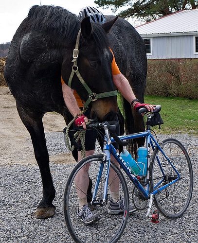
To repeat the refrain from my last several posts, I arrived in California in the morning of Saturday, November 1 with a primary purpose other than gathering content, to affect the parlance of the Web, for the Los Padres Expatriate Hiker. But that did not preclude opportunistic purpose-divergence and indulgence in some time in the hills. I was situated in Ojai after all, and, as one of my grand nieces might say, the forest is “just, like, over there.”
Tamarisk
I had nothing I needed to do Sunday, February 2, 2014 and, as so often happens, hiking guide author, forest steward and scout master Craig had a service excursion planned and invited me tag along. Bless his expansive heart, Craig has consistently and generously endeavored to help me get my neurons firing in a coherent manner during these flash trips to California. He is a man undaunted by a challenge.
The object of the service day was removal of invasive tamarisk from a tributary of the Sespe River. I’ll not say much about the project as I am not at all qualified to speak to the natural history of tamarisk in the Los Padres. But it was a dual-Zen day: pulling big weeds and framing photographs is an effective way of banishing non-productive mental wanderings.

Mary and Marcus bag a multi-point tamarisk, February 2, 2014.

An unnamed place along an unnamed tributary of the Sespe, February 2, 2014.

Another unnamed place along an unnamed tributary of the Sespe, February 2, 2014.

Yet another unnamed place along an unnamed tributary of the Sespe, February 2, 2014.
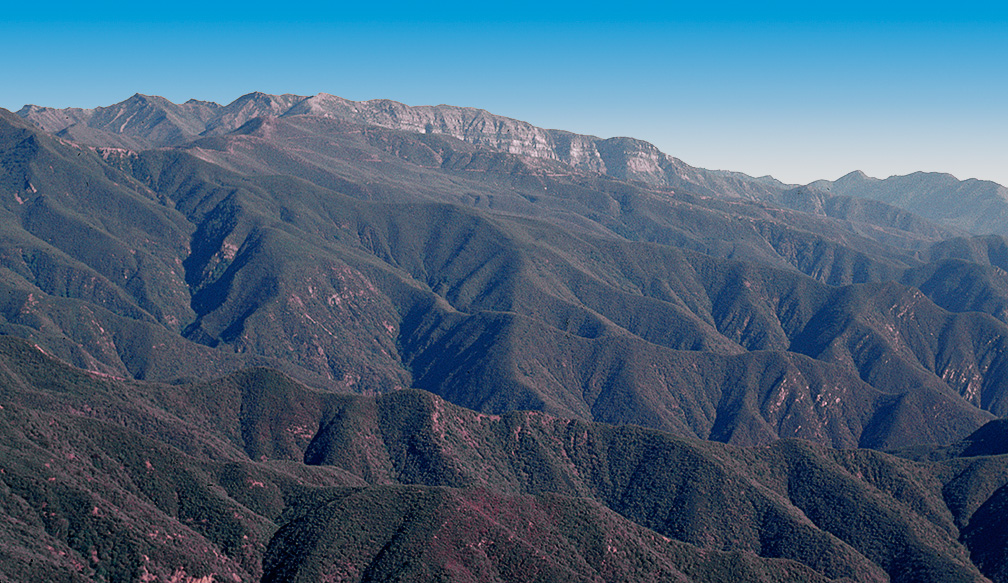
Nordhoff Peak, Feburary 4, 2014:
Wherein I abandon my accrued wisdom concerning walking in the wild.
One ventures into the backcountry to find clarity and perspective, a topic eloquently examined by Los Padres adventurer and philosopher Jack Elliot. A corollary statement: One must leave behind other concerns and be focused in the pursuit of backcountry clarity and perspective. To abandon focus is to be foolish as will be exposed in the following narrative.
I discovered after a long day of having a long day that Tuesday, February 4, 2014 was commitment free. I was not in any way mentally available for a logistically complex undertaking but there was what I perceived to be a modicum of kismet at work. I needed a big hike test of my recently repaired left knee to confirm the successful modest trail stress test of November 2, 2014. Also, a cloudy day was predicted and I had long wanted shots from Nordhoff Peak with structured sky and dramatic cloud-filtered light. What could be a simpler way to accomplish both goals than a hike on the Pratt Trail to Nordhoff Peak? And what could be less fraught with complication than the short drive up Signal Street to the Stewart Canyon debris basin trail head when one is already located in Ojai? Voila; nothing to it.
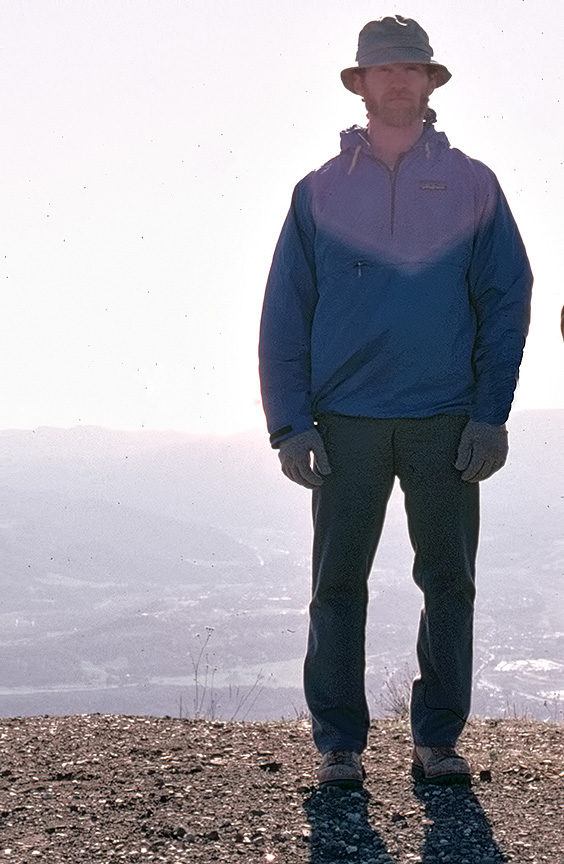
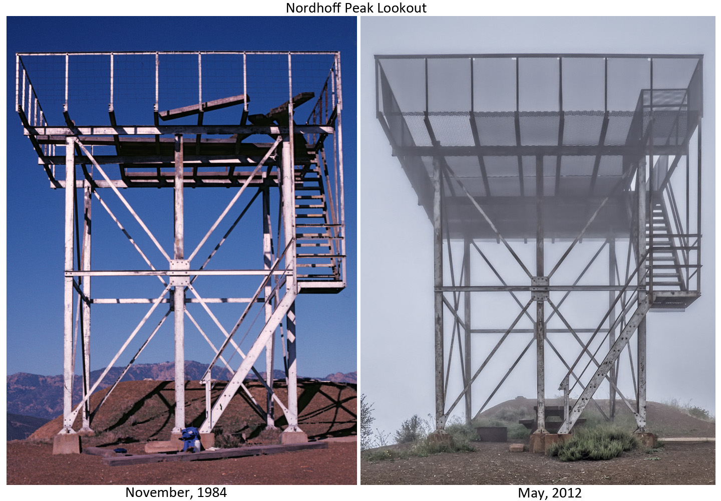
Nordhoff Peak, December, 1984; a study in the optical physics of lens flare.
In the morning of Tuesday, February 4, 2014, I mindlessly loaded my pack with photographic gear and a few bits of hiking paraphernalia and arrived at the Pratt trail head at 7:00 AM. I walked the route to Nordhoff Peak without removing my camera from the chest pack in which it rode. During the course of the hike my mind endlessly, fruitlessly, looped through a number of topics irrelevant to the purpose of the day. I was so imperceptive that I did not notice the spur trail to Valley View camp and had forgotten my intention to visit the location and perhaps take some pictures. “Oh well,” I thought, “I’ll stop on my way down.”
When I arrived on Nordhoff Peak, I had had the sky I had imagined. My mind did an immediate context shift to real-time photography mode. I set up the tripod, calibrated panoramic head and camera components for sweeping an arc east to west of the view of the Ojai Valley and the Pacific Ocean. The angle of the sun was such that the lighting problem was complex, given the wide dynamic range from ground shadow to sky highlight. I decided to attempt a high dynamic range panorama. Each frame of the panorama would be comprised of a tone-mapped composite of five shots ranging from +2 to -2 EV in one EV steps. I shot the panorama in two rows of 17 frames per row at 0 degrees and -15 degrees relative to the horizon. Thus, the panorama below is a merged and stitched composite of 170 individual photographs (click to see a larger version in a new window for all photos in this post).

Panorama from Nordhoff Peak of the Ojai Valley and Pacific Ocean, November 4, 2013.
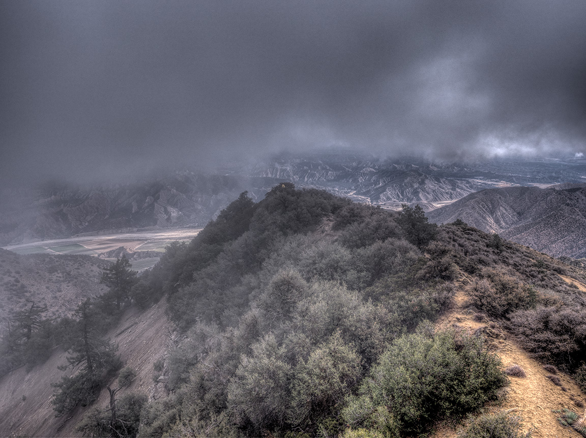
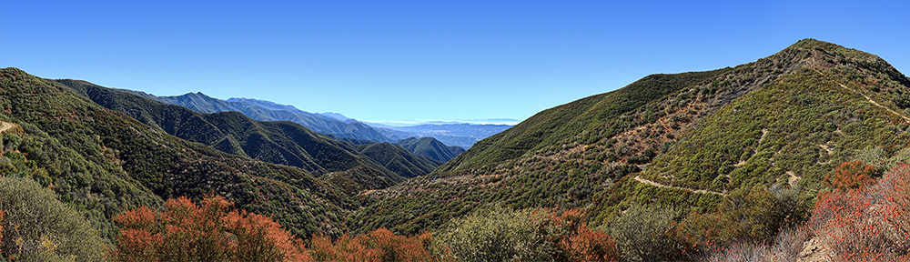
I then set up a short distance north of the old Nordhoff lookout to get a panoramic view sweeping across the Sespe Wilderness and Pine Mountain. With the sun essentially to my back, the front-lit scene did not present the dynamic range challenge of the southerly panorama; hence, I chose not to use a high dynamic range strategy. The panorama again swept a very wide arc; the Topatopa bluff, which appears frame left in the first panorama can now be scene frame right.

Panorama from Nordhoff Peak sweeping the Sespe Wilderness and Pine Mountain, November 4, 2014.
I had to take the obligatory shots of the Topatopa bluff and the Nordhoff Peak lookout because that is what I do. To deny one’s identity, I have been told by acquaintances who think deeply on such topics, is to inflict some sort of psychic damage or something. I’m not sure I understand the reasoning but I’m not risking further psychic deficit. So I set up the tripod and kept potential psychic damage at bay.

Topatopa bluff from Nordhoff Peak, November 4, 2013
Telephoto view of Topatopa Bluff from Nordhoff Peak, December, 1984

Nordhoff Peak Lookout, November 4, 2014.
 After the better part of three hours burning flash card space I began the return trek west along the Nordhoff ridge fire road toward the intersection with the Pratt trail. I bade farewell to the lookout from about one half mile west with a wide angle shot of that stalwart edifice framed between two skeletal trees.

Viewing the Nordhoff fire lookout from the west. February 4, 2014.
As I approached the intersection with the Pratt trail, I became aware of a view of the Ojai Valley, Lake Casitas and the Pacific Ocean. In my state of distractedness, I had missed this obvious photographer’s fodder on the way up. I felt the scene required careful framing to do it justice, so I dropped my pack and set up the tripod with the leveling head and micrometer elevation clamp.

The Ojai Valley, Lake Casitas, Pacific Ocean, Anacapa Island and Santa Cruz Island, February 4, 2014.
I reached the junction with the Pratt trail and noted the expansive view north. I was vaguely disturbed that this, too, had failed to make an impression when I had passed by on my way to Nordhoff Peak. Where was my head? I would find out later, bear with me.

View north to Pine Mountain from Nordhoff ridge, February 4, 2014.
Once I finished exposing the 80 frames that would eventually be fused into the panorama, I descended the Pratt single track from the junction without noticing anything I can remember until I arrived at the junction with the spur to Valley View camp.

A rarity during the extended drought conditions afflicting California: Water in the Southern Los Padres at Valley View camp, February 4, 2014.
I left Valley View camp and once back on the Pratt trail, my mind to returned to musing topics that have heft but were irrelevant in an immediate sense. I have no clear memory of exiting the Pratt single track. The mental claxons began howling when the dirt road route I was following terminated at a fence line with a prominent “No Trespassing” sign. Irrespective of my degree of inattentiveness, I knew this did not belong on the route back to the Pratt trail head.

This is where things went to hell. I discovered this picture when I reviewed the raw camera files during the writing of this post. I do not remember taking this picture. In my distracted state I followed the route to 23W26 (Cozy Dell trail) rather than taking the hard left to follow the Pratt trail back to the Stewart Canyon debris basin. February 4, 2014.
What I had done is obvious to anyone who knows the route, and I do know the route; in fact, I had walked a large part of it trouble free as recently as March 20, 2013. However, I adamantly refused to believe I had made the error I had so clearly made. A short consultation with a simple trail map would have burned through the cognitive fog but I had had left the map behind (contemplate briefly that statement in all its wrongness). The GPS I was carrying to record tracks is useful for establishing a precise location in the context of a lager overview from a map, but the screen is simply too small for me, in many cases, to use the internal maps to get an overall sense of a route. This was such a case.
I began to backtrack but I had no idea how far I had come from the end of the Pratt single track. As I backtracked, I passed a junction with the Cozy Dell trail that pointed west, two miles, to Highway 33. So, I could always bail in that direction and call a reliable number in Ojai for a ride back to the Pratt trail head. But that is not what I wanted to do; I wanted to get back to my vehicle. Of course, this trail sign clue should have convinced me of the reality of what I had done; I know exactly where the Cozy Dell trail emerges on Highway 33.
At this point my phone alerted me to an incoming text message. I am not one given to speculation on metaphysical providence but the text was from the author of Hiking and Backpacking Santa Barbara and Ventura. I hesitated briefly, then threw up my metaphorical hands and placed the call.
Craig requested a GPS coordinate and a general description of my location. While he digested this and took care of some other business I backtracked a bit further. I came to a point where the road headed sharply uphill northwest and a dozer cut diverged south and came to a dead end at a ridge overlook. From the overlook I confirmed that at least I properly knew my geographical orientation. The dirt road heading northwest was another clear indicator of my precise location but, given that I did not remember coming down that road, I decided to wait for the return call from Craig. It was too late to salvage any dignity.
That call arrived shortly and I chose to believe that Craig’s laughter was due to a great joke he had just heard on the radio. He had me head back toward the junction with the Cozy Dell trail (which I had already started to do) and alerted me to the junction heading east that was a short distance north of the Cozy Dell junction. I had not noticed this at all on my way down but it had vaguely registered when I backtracked. “Foothill trail” was clearly inscribed on the sign. Craig said something along the lines of “Do you think if you follow that trail 1.2 miles east good things will happen?”
I am not one given to gratuitous swearing (OK, that is a bit of poetic license; please bear with me) but my internal dialog was not appropriate for polite company. A phrase ran through my head in an endless loop: “head up the ass.” Following the Foothill trail 1.2 miles east would drop me back on the Pratt trail exactly where I know the Foothill trail intersects the Pratt trail from the west. From there it was a moderately short walk back to my vehicle. I finished the hike with head lamp illumination; darkness fell shortly after I regained the Pratt trail. I had remembered to bring my headlamp.  I had traveled, per my GPS, 16.7 miles that day with an elevation gain of 5,214 feet. My left knee was slightly stiff but free of pain and swelling. It appears the surgery of July 25, 2013 had passed a profound stress test. Beyond that, this story has no moral that requires articulation; the moral is in the telling.
Chorro Spring, February 7, 2014
I have previously described my long association with Sentinel Trees trees that flank the trail to Chorro Spring. 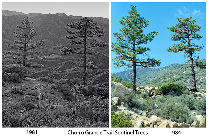 I very much wanted to photograph the trees against a sky with light structured by clouds. A bright, blue sky is a wonderful thing, especially if one is experiencing another winter in the Lake Erie snow belt, but I did not want to photograph the trees under yet another blue sky.
 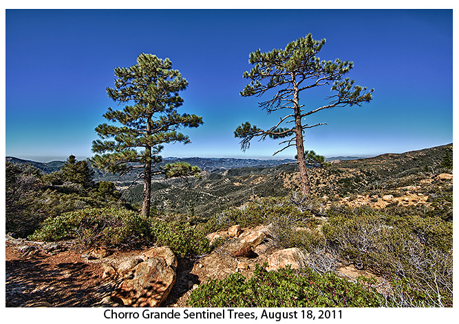 There is a photographic principle, “chasing the light,” and, cliche though it might be, when cloudy skies were predicted for Ojai and environs on February 7, 2014, I hustled to clear my schedule with the intention of chasing the light on the Chorro Grande trail.
Early on Friday, February 7, 2014, I prepared for the 35 mile drive on Highway 33 from Ojai to the Chorro Grande trail head. Before I left I carefully determined, chastened as I was by my Nordhoff Peak fugue of February 4, that I was no longer experiencing a recto-cranial inversion. Assured that my head was not, in fact, embedded in my butt, I drove without drama to the trail head.
I ascended the trail easily as the cloud cover built and arrived at the trees with a rapidly shifting, but always interesting, cloud-structured sky. I spent a perfect two hours photographing the Sentinel Trees.

Chorro Grande Sentinel Trees, west view, February 7, 2014.

Chorro Grande Sentinel Trees, west view, February 7, 2014.

Chorro Grande Sentinel Trees, west view, February 7, 2014.
After bidding the trees farewell (I talk to them; so far, in 40+ years, they have not answered), I walked to Chorro Grande camp for lunch. The flow from the spring was weaker than I had ever seen, emblematic of the extended California drought.
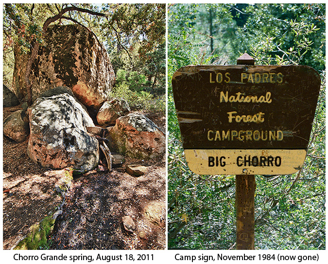
The sign on the right used to be located just to the left of the rocks from which issued the spring.

Chorro Spring, February 7, 2014.
After lunch, I hiked back to my rented Jeep Patriot parked in the familiar turnout just off Highway 33. Conditions for photography remained outstanding on the descent.
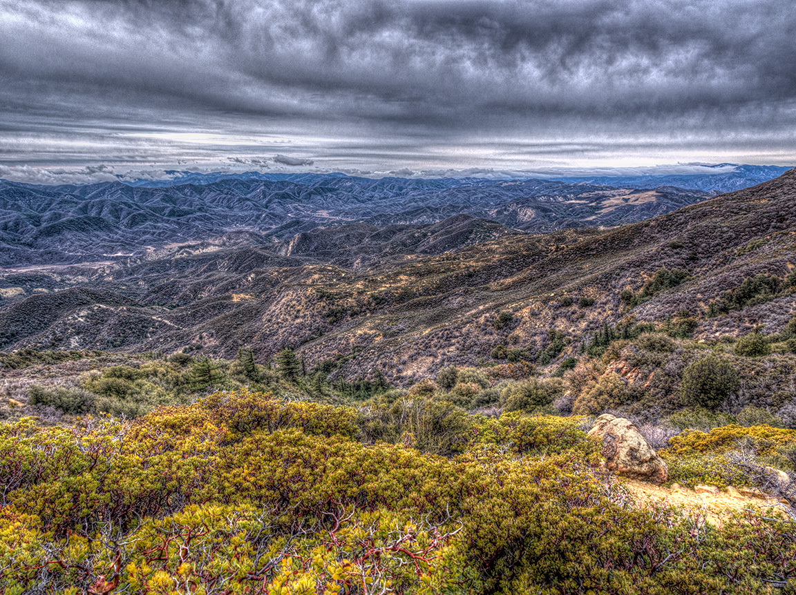

View west from the east slope of Pine Mountain, February 7, 2014.

View west from the east slope of Pine Mountain, February 7, 2014.
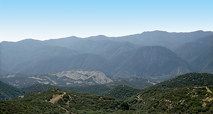
View west from the Chorro Grande Trail, 1981.

Southwest view from the Chorro Grande trail near Oak Camp, February 7, 2014.

This turn across a wash in the Chorro Grande trail west of Oak Camp ranks just below the Sentinel Trees and Chorro Spring as an enduring iconic landmark of the trail. View north, February 7, 2014.

Chorro Grande trail west of Oak Camp, February 7, 2014.

Start and end to the day: The Chorro Grande trail head sign, February 7, 2014. When I last hiked this trail, August 18, 2011 this sign was not present.
I reached Highway 33 without drama after an outstanding day with pack, camera, trees and spring in the Southern Los Padres. I did not have to chase the light; the light was with me.